Wednesday, June 29, 2016

[Christina] Day 8: Entertaining Road Signs

Here are a selection of entertaining road signs from our drive across Montana. [Elizabeth sidebar: Montana seemed to have the most amusing selection of road signs that we encountered this trip... I thoroughly enjoyed spotting them, and poor Christina had her work cut out for her trying to take pictures of all of them as we sped by.]
There were maybe ten or twelve of these signs arranged in a semicircle.

Is there a Hungry Hungry Hippo dam?

RV Park and Yurt Village

Lake Five

Helicop-tours

Is this where you take your sick dinosaur?

Boston's, The Gourmet Pizza.  So Boston is famous for pizza?  The things you learn as a Boston resident in very rural Montana.

University of Great Falls, with a cross on the sign.  Elizabeth and I had a long debate about which of the two of us would be less likely to be hired by them.

And yet, we did not stop in historic friendly Stanford.

No shrinking violets, these folks.

Gambling analogies were pretty common in anti-drug PSAs, but I'd never seen them outside of this area.

[Christina] Day 8: Glacier National Park and the K-T Boundary

We left Sally's place very early (thanks again, Sally!) and drove north to Glacier National Park.  We drove up through the fog, which we soon realized was just a cloud because we were so high up in the mountains.  As we drove through the park, the low-lying cloud lent an otherworldly feel to the landscape.  It was like something out of Middle Earth. [Elizabeth sidebar: This was easily my favorite part of the drive thus far. Glacier was both un-crowded, and just a beautiful alpine but not totally alpine forest. The fog made it magical, and it was so unbelievably amazing. It's a fantastic park, though definitely far from the beaten path.]
 Eventually we climbed high into the mountains as the road skirted along the peaks and passes.
As the name of the park promised, we did get to see a real glacier. [Elizabeth sidebar: sadly, though not unexpectedly, there was a sign at the glacier overlook showing pictures of what it once looked like. I do feel blessed to have gotten to actually *see* a glacier, and sad that they probably won't be around much longer... This trip's carbon footprint weighs somewhat heavy on my mind, but the Power Prius does get great gas mileage, and further, once I'm settled, I will be driving much, much less than I did in San Diego, so there is that, at least.]

Once we were out of the park, we cut across the length of Montana, which sure does have a thing for entertaining road signs,  I suspect some of these were unintentionally humorous.

We did have time for one spectacular roadside geology stop, though-- the K-T boundary!  The Roadside Geology of Montana had mentioned that there was an exposure of the K-T boundary in one particular place, and Elizabeth, connoisseur of the  K-T boundary, insisted we make a stop. [Elizabeth sidebar: I spent my dissertation thinking about the K/Pg basically all the time. While it must have been one really bad Thursday* afternoon for the planet, it really is fascinating from a paleobiological standpoint.]
We scrambled around the side of the road so I could check out the exposure up close and Elizabeth could do a handstand on it. [Elizabeth sidebar: I collect pictures of handstands at geologic outcrops. This is my second K-T boundary handstand - the other was at Gubbio itself, where I was able to put one hand on each side of the boundary. Here, I got to touch it!] Once we wrapped that up, we figured we better high-tail it back to the car so we didn't get shot or something.
We had planned to camp at Theodore Roosevelt National Park, just across the North Dakota border.  Their campground was full, so we ended up camping at a nearby commercial campground.  We were exhausted after a 13+ hour day of driving-- turns out Montana is really big-- so after setting up the tent in an especially efficient 20 minutes, we collapsed inside.  Ah, sweet relief.

Wait.

What was that sound?

THUNDER!!! [Serious thunder and lightning]
Pretty sure it was this massive thunderhead we saw on the way in.
We dragged our pillows and sleeping bags out of the tent back into the car and alternately napped fitfully and giggled at the absurdity of the situation as we waited for the thunderstorm to pass.

Finally, it did, and we got to zonk out in the tent for good.

Saturday, June 25, 2016

[Christina] Day 7: Sally and Rich's Place

(Day of June 25th)

We had a rather calm day of relaxing and hanging out with Sally and Rich Thomason, punctuated by a Sally-led hike through the woods.  We talked paleontology and linguistics, and she pointed out points of interest for the plants and animals of the region.  Here is the pretty!


[Christina] Day 6: Tetons and Yellowstone!

(Day of June 25)

We woke up early and set out for The World's Longest And Most Scenic Drive-- Craters of the Moon to rural western Montana via Grand Teton National Park and Yellowstone! [Elizabeth sidebar: it wasn't that long, except for the traffic jam]

Before we left Idaho, we FINALLY managed to grab a photo of this sign, which I unfortunately couldn't find when it came time to make this post.  Anyway, other states have Wildlife Crossing; Idaho has Game Crossing.  Interesting implications for the relationship of this state to the natural world.

We also drove past the site of the world's first nuclear power plant.  Unfortunately, we didn't have time to stop and look around.

The Power Prius was a real trooper and got us up the mountains to the top of Teton Pass [barely].  Of course, there were glorious photos from the top.
Our elation quickly turned to grumpiness when we got stuck in traffic in Jackson, WY.  Far too built up and affluent for our tastes, we who had gone three days without showering at one point!

Once we reached Grand Teton, however, the traffic dissipated and the scenery was astoundingly beautiful.

From there, it was a quick drive to the entrance of Yellowstone.  The rivers and falls near the South Entrance look like something out of a Bob Ross painting.

At Yellowstone, we had one mission and one mission only: find Norris Geyser Basin. [Elizabeth sidebar] My PhD advisor, Dick Norris, is just about the most knowledgeable person about field sites and places to visit ever. Seriously, I swear he's been pretty much everywhere. He also happens to share the name of Norris Geyser Basin. So when he suggested it as a less crowded and prettier alternative to Old Faithful, that sounded like a fantastic decision. It was still somewhat busy, finding parking was an adventure, but it was SOOOO worth it. Pro tip, if you want to see geysers at Yellowstone, and, you *want* to see geysers at Yellowstone, Norris Geyser Basin is pretty epic. [end sidebar]
We did still manage to see some bison, though.  They are fuzzy and adorable and look like they could kill me in a heartbeat if I made them mad.
There were many lovely rhyolite deposits on the way out of the park.
[Elizabeth sidebar] We had one other very special occasion in Yellowstone: the Power Prius turned 100,000 miles. A fitting place for such an auspicious moment. She's been quite a faithful car thus far, and I hope she continues on for another 100,000 or more. [end sidebar]


From Yellowstone, we drove to Condon, MT.  Why, you ask?  A few months earlier, I had some awesome linguistics research which I wanted to run by Amazing Linguist Sally Thomason at the University of Michigan.  I wrote asking if I could visit her in Michigan.  No, she replied, I'm going to be in Montana, but you are welcome to visit me there, but it's not really on the way to anywhere except Glacier National Park... 

YES, SALLY!!!  [Elizabeth sidebar: I've always wanted to see glaciers before they disappear, so this is a *great* excuse to do it]

We had trouble getting in touch with her, and had ended up only contacting her the day before.  She agreed to host us on one day's notice, which was really, really, really nice of her and her husband Rich.

Getting there proved to be something of a challenge.  We got hit by heavy rain on I-90, and then got stuck in stop-and-go traffic for nearly an hour between Bozeman and Belgrade due to a collision which involved (by the time we got there) four police cars, two fire vehicles, and nine other cars spread across the shoulder. [Elizabeth sidebar: note that this was probably at least 1.5 hours after the accident, and all ambulances were gone from the scene. At least a few cars had also already been towed, as we had seen tow trucks driving past us. Quite a doozy, and we hope that everyone survived.]
At some point after we turned off I-90, we had to stop for gas.  I needed to use the restroom.  I asked an employee about it and was told that the women's restroom was already locked for the night and that I would have to use the men's.  No thanks!  Elizabeth needed to use an ATM.  There was one, but it was in the combination lounge and casino adjacent to the convenience store.  No thanks!  We continued onwards, though we did get a full tank of gas.
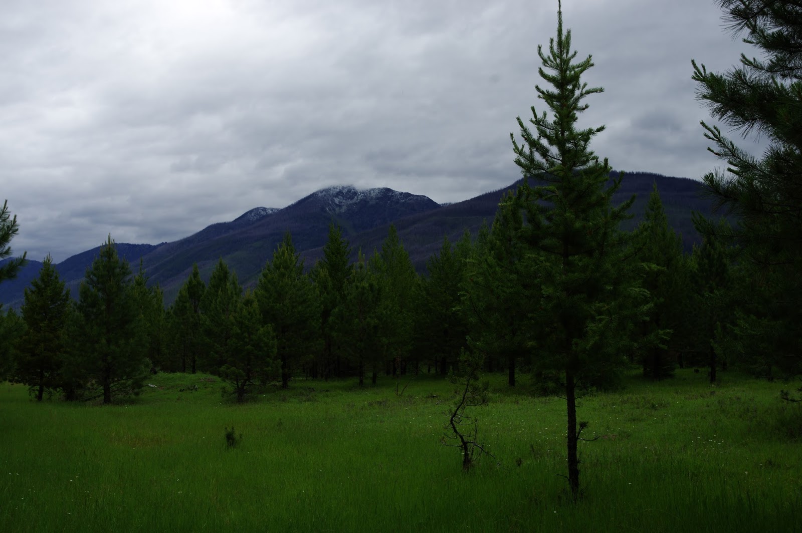
As we reached more rural areas, the roads got narrower and narrower and it got darker and darker and rainier and rainier with more and more deer culminating in a tiny dirt road with huge puddles.  It was nutty. [Elizabeth sidebar: it's a darn good thing I drive giant vans for field trips on crazy off-road adventures on a regular basis - this was definitely an adventure, and the Prius did very very well in its newly minted 100k miler state... Sometimes I feel like we should be feeding the car apples at the end of the day for a job well done or something]

But still, we persevered, and finally made it to Sally's.  Thanks, Sally, for letting us stay with you!  She and her husband live in an actual log cabin in the woods with a wood-burning stove and a dog with a Salish name and it is pretty much the coolest thing ever.

[Christina] Day 5: Craters of the Moon

(Day of June 23rd)

We ate breakfast at the hotel (biscuits and gravy and breakfast sausage!  Hooray for calories!), finished our wifi time, and set out north for Craters of the Moon National Park.  We drove through open fields, and then...BASALT!  The grassland suddenly gave way to a desolate black basalt field, with virtually no vegetation. [Elizabeth sidebar] Craters of the Moon is so named because when people first started exploring it, they thought "this is a really crazy landscape. The moon has volcanism. I bet it is what the surface of the moon looks like." And hence, the name. [end sidebar]
Fun geology facts about Craters of the Moon: The volcanism at Craters of the Moon is due to a hotspot, not subduction, unlike the nearby Columbia River Flood Basalts.  It is mostly rhyolite with a thin layer of basalt on top.  There is currently no active volcanism, but this formation is relatively recent-- the most recent lava flow is 2,000 years old.  It looks it, too, since in many cases there is very little plant growth.  [Elizabeth sidebar] You could definitely tell both how much younger or older certain sections and flows were based on how many plants there were, and also where the flows stopped because of where plants weren't. It was really spectacular. Some of these young eruptions probably occurred when Native people were in the area, and it would be fascinating to hear what (if anything) made it into the oral histories of the native tribes. I am torn as to whether I'd want to have been around to see it, or would not want to be anywhere near the area... [end sidebar]

At the visitor center, we talked to a nice ranger who told us three useful things:

(1)  Grab campsite 13 because it's the most sheltered from the wind;

(2)  Go up the cinder cone.

(3)  Go see the lava tubes.

We did all three of these things!

First, we grabbed campsite 13.  This was crucial because it was VERY, VERY WINDY.  It was a circular hole in chest-high lava flows with a narrow passageway in.  So cool. [Elizabeth sidebar - and soooo much less windy!]
Second, we climbed the cinder cone.  IT WAS SO WINDY.  SO WINDY.  SOOOO VERY WINDY.  This was the most forceful wind I've ever experienced.  It was so windy I had to set my camera to ISO 400 in bright daylight so that the pictures wouldn't be blurred by the wind shaking my hands.  It was so windy I had trouble breathing.  It was so windy that at some points I had to sit down so that the wind didn't blow me over.  IT WAS SO WINDY. [Elizabeth sidebar - it was so windy that gusts of wind actually hurt. It felt like downhill skiing in uphill wind. It was fun, but oh, so windy]

But the view was great.

And there was actually a tree growing at the top of the cinder cone in a relative wind shadow. [Elizabeth sidebar - thanks random grasses that somehow grew on the top of the mountain]

We visited a couple other cinder cones, then went on to the lava tubes.

Before the lava tubes, here is a lesson in basalt flows.  There are two types of basalt flows, produced by basalt of different viscosity due to differing amounts of water in the lava. 

Pahoehoe has relatively large amounts of water, flows smoothly, and makes a smooth, wrinkly crust.  Lava tubes can form in pahoehoe as the lava cools and a crust forms on the surface, but lava keeps flowing beneath.  This is what makes lava tubes.
 

Aa has relatively low amounts of water, is very viscous, and forms a crackled, broken crust.  Very nasty to try to walk on. [The Hawaiians will tell you that "aa", pronounced "ah-ah", is the noise you make if you walk on it]
Some of the lava tubes were small and somewhat dangerous to explore, but one of them was several stories tall. [Elizabeth sidebar: there were several which you could crawl into if you had a trusty headlamp. Unfortunately we had only one trusty headlamp, and it seems that groups of 4-8 are optimally sized for adequately lighting the caves... Apparently the cave called "Boy Scout Cave" is the one to go to - it's a ~500 foot tunnel that ends with icicles! Unfortunately we just had to enjoy pictures, since there weren't enough of us to safely explore the cave.]

In several locales around the park, there were sparse flowers blooming across the black soil.  So beautiful. [Elizabeth sidebar: some of these flowers were a species that only blooms for a few weeks in mid-June: we picked exactly the right time to visit!]
[Elizabeth sidebar] We set up the tent in the not-so-windy circle of rocks at Campsite 13 (lucky 13), and had to be pretty careful about the wind - it kept blowing around everything, so we quickly put it up and put heavy bags in it to help hold it down. We shouldn't have worried, though: with the setting of the sun, the wind disappeared. [end sidebar]

We had an early night in order to wake up early for the next day's adventure-- Yellowstone! And Grand Teton National Park!

[Christina] Day 4: Curiosities Glimpsed by the Side of the Road

Who doesn't love roadside America?
Vernal has a lot of dinosaur stuff.
Lots and LOTS of dinosaur stuff!

And a helicopter.

Some Sinclair gas stations have actual dinosaur models out front.

Elevation larger than population always amuses Elizabeth.
 
What a great name!

Or, a la Davy Crockett, you could be going to Texas.

Not Texas A&M!

No Harvard Street yet!

[Christina] Day 4: Adventures on the Utah Prairie

 Back to the restaurant where we ate lunch.  We asked the waitstaff how to get to the Great Salt Lake.
They were very friendly and helpful, and recommended we go to Spiral Jetty. [Apparently our waiter had recently taken his engagement photos here.]  Spiral Jetty was only accessible by a gravel road, but one of the waiters assured us that we could do it because he'd made the trip with a sofa in his hatchback.  He also drew us the mappiest map ever. 
Note how north-south I-15 runs right-left.  Also note that all annotations were added by Elizabeth.

Luckily for us, Google saved the day and provided us with some actual directions.  We set out after lunch. 

On the way to Spiral Jetty, we came across Golden Spike National Historic Site.  We didn't know what it was, but since it was on the way, we were definitely going to stop there.  Elizabeth thought that it was a monument to stratigraphy, and that the golden spike referred to the golden spikes geologists place at the type site for stratigraphic boundaries.  We had a rousing discussion about the goals, benefits, and limitations of stratigraphers and their approach to geology.

When we got there, it turned out that Golden Spike was...railroads.
It turns out that this was the place where the transcontinental railroad was completed, with the last spike being made of 18-karat gold. [Elizabeth sidebar: the actual golden spike is in a museum at Stanford University, because why not].  The museum was a real gem.
"Used to treat infections incurred while fraternizing with women of the evening."

The caption how many people were killed by such devices in one particular year, and states "You be careful, too."
The railroad was a massive engineering effort but the completion of it was a comedy of errors.  Two railroad companies started at opposite coasts and planned to meet in the middle.  When they got to the middle, they ended up missing each other.

Once that problem was sorted out and the railroad was one spike away from completion, the heads of the railroad companies were given the chance to drive in this final railroad spike. [This was a huge to-do, with people traveling in for weeks from all around the west.] They both swung and missed.  The actual people who did the actual work on the railroad had to come along and finish the job.

We then set out for Spiral Jetty.  We drove a very long way along a very washboardy gravel road with NO TRESSPASSING PRIVATE PROPERTY KEEP OUT!!! signs on either side, but luckily the directions the webpage provided were very good - 4 cattle-guards, several dirt road forks, and a number of little inconspicuous white signs saying "spiral jetty" with arrows later, we found it.

When we got there, though, it was entirely worth the trip.  How gorgeous!  Yay basalt! [Elizabeth sidebar: in addition to the beautiful jetty, which was completely dry when we got there, we saw a bunch of evaporite depoits, some with highly concentrated salty water from the Great Salt Lake. We didn't actually make it to the lake edge proper, it was probably another mile away, since the water line was relatively low, but it was really gorgeous, and I still got to stick my finger in Great Salt Lake water, which was awesome.]


The day's adventures were not yet over, however.  We left Spiral Jetty and headed back up to I-84 by a different route.  There, we discovered a missile testing facility with an exhibit out front. [Elizabeth sidebar: I wonder what crazy things happen at this national lab - we are sure that the missile exhibit is there to distract any tourists who happen to get this far - seriously, it's *way* off the beaten path.]
In short, we found a space shuttle solid rocket booster in the middle of the Utah prarie on UT-83. [Elizabeth sidebar: apparently this place is popular enough that it needs a sign to tell the unsuspecting tourists to *not* crawl into the base of the giant rocket booster... I didn't, but I did get a great handstand picture.]
After that, we had an uneventful drive up to Idaho where we stopped for the night at a hotel in Burley, ID.  Hooray for showers!  Hooray for wifi! Hooray for $2 laundry!